


Product Details
+
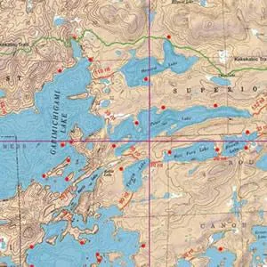
McKenzie Maps are ideal for finding your way around the BWCA and the Quetico. They clearly show portages, campsites, and land contours and are printed on 25" by 30" pieces of plastic paper that doesn't shred when it gets wet. With a scale of two inches to the mile and hill-shaded topographic details, they will let you travel the boundary waters with confidence. All maps are reviewed for accuracy by officials from Quetico Park, U.S. Forest Service, and Minnesota DNR as well as by guides, outfitters, and resort owners.
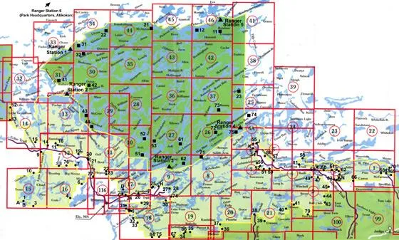
Find your map number here:


